A morning in Mauritania (OSINT challenge)
I solved the OSINT challenge n°1 made by the renown analyst Sofia Santos. I will try to stick to the Intelligence Life Cycle as much as I can.
The plan
- What needs to be answered: the goal is to locate the exact place depicted on the picture.
- What platforms should be accessed: at least Google Earth or Google Maps. Maybe Yandex reverse image search.
The collection and processing
The input image of the challenge where I highlighted the important parts:
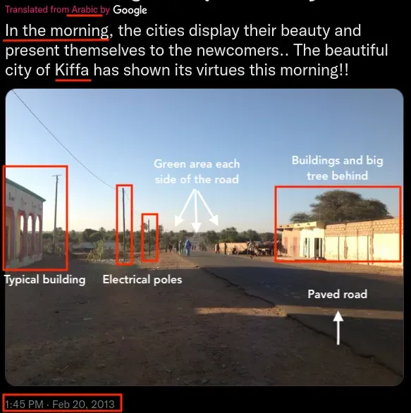
Well, a lot of information can be noted, but careful none of these things can be actually be taken 100% for granted, but it gets us on track:
- City name: Kiffa
- Language: Arabic (translated to English)
- Time: 2013/02/20 — In the morning (text and sun exposure)
- Physical elements:
- Paved road (might be rare at the location)
- Electrical poles
- Building with arches and scriptures on the left (sunny side, east)
- Buildings on the right with a tall tree behind
- The road pass through a green area (might be rare)
- Sun is rising from left (see the shadow casting) so it’s a north-south road
- Road itself goes slightly to the right.
Interestingly, Yandex reverse image search yields a picture of Kiffa as first result, reducing bias induced by the text:
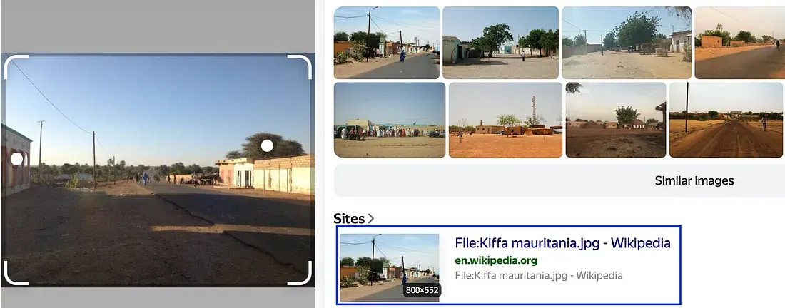
There’s only one match for “Kiffa” on Google Earth/Maps (in Mauritania).
First, I’m going to focus on the roads, looking for a paved one, perpendicular to the sun east-rising and passing through a green area, so I trigger Google Maps first and will switch to Earth when needing more precise imagery. Not much paved roads in Kiffa:
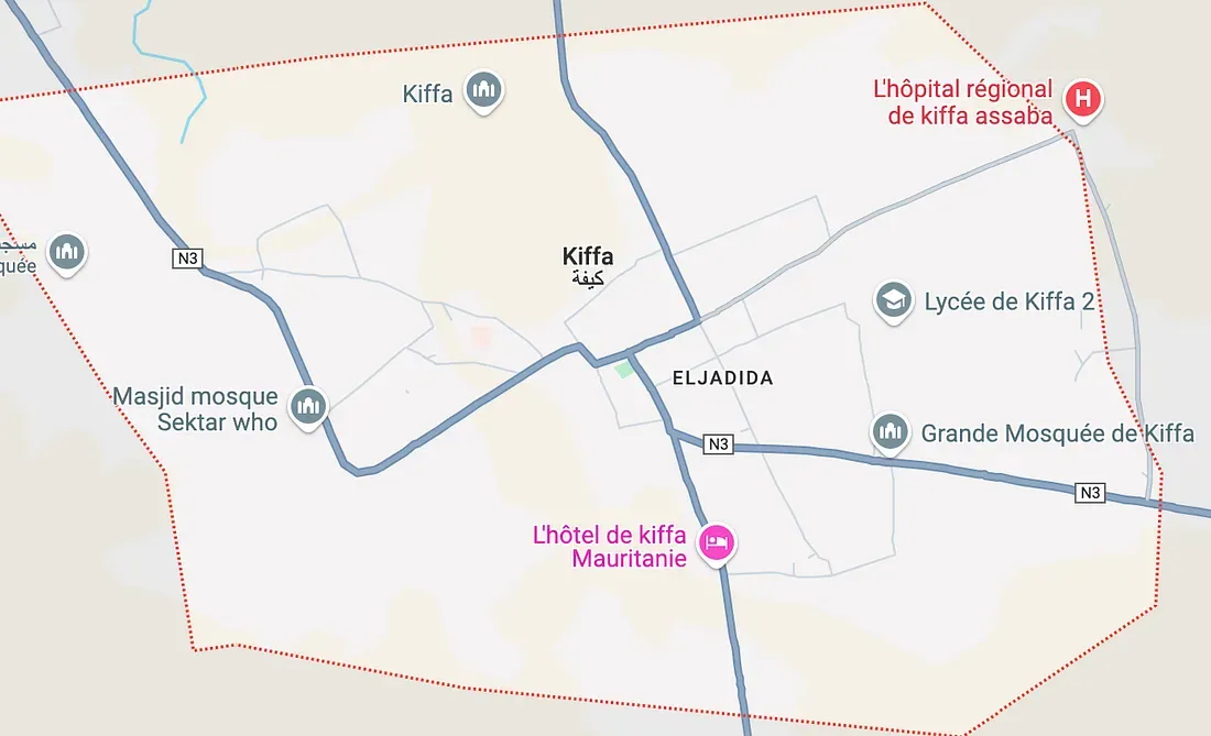
Switching to satellite view, this road matches with the requirements (going south, trees area on each side):
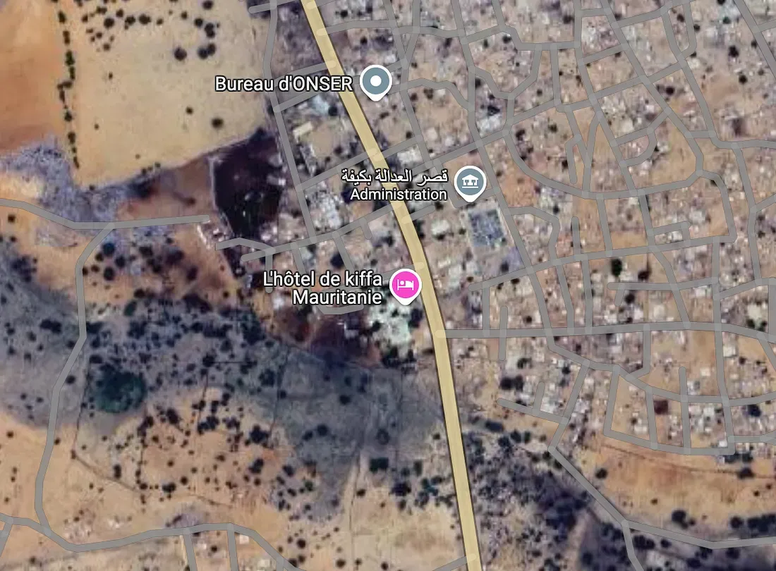
I hit Google Earth with an approximate GPS coordinates, do a 180° rotation and use the embed archive tool to view imagery closer to the date of the input (2013), the 2013 archive is less readable but the archive before (2010) is cleaner:
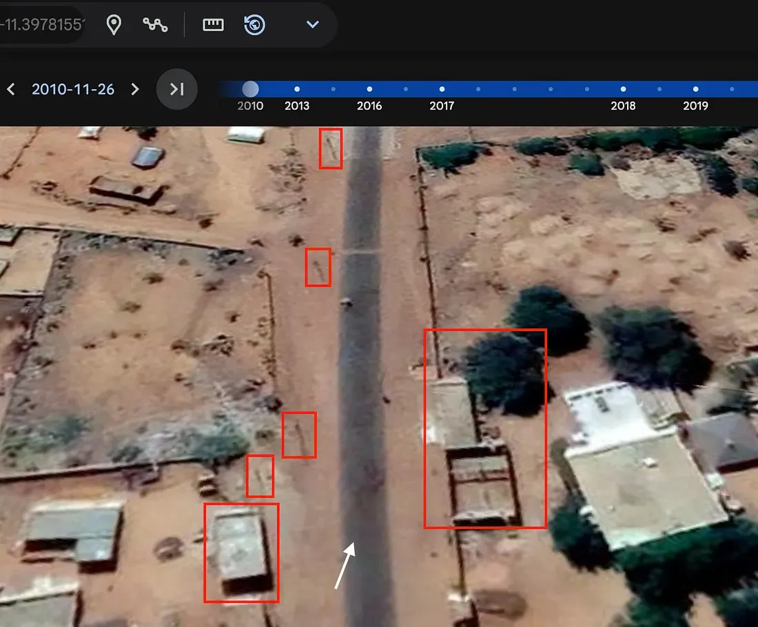
After a few seconds of wandering on this Mauritanian road, we can notice the pattern detected earlier. Buildings + big tree on the right, building next to an electric pole on the left, more electric poles along the road, paved road, in the right direction and going towards a greener area with a slight tilt to the right:
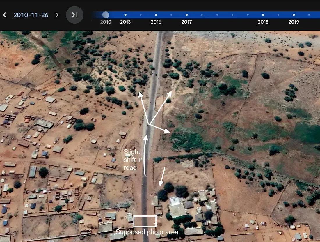
The top area is greener in 2013 and looks like more of the input:
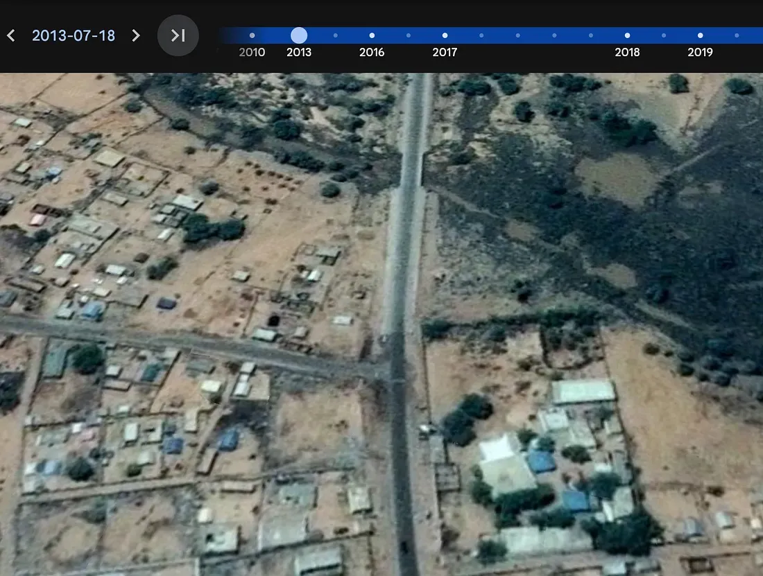
So this is it, we supposedly have our place figured out. Now a few notes.
Calling out gaps
The reliability can be discussed here as the area lacks Street Views to produce an evidence that perfectly matches the input.
I’d score Reliability with 4/5 and Bias with 1.5/5.
We could investigate the scriptures on the left building, but again, lacking Street Views I’m not sure this would be helpful in our case.
Conclusion
This challenge was interesting as the area is really remote, and following the intelligence cycle has helped me to be more focused and critical towards the findings.